14. July 2025
Ströer's digital media show real-time data for Park+Ride at major events in Hamburg
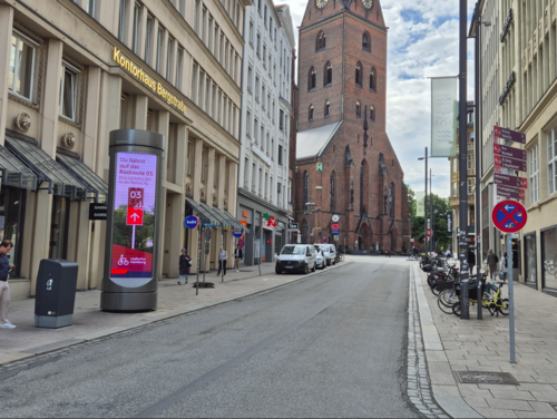
In cooperation with the City of Hamburg, public mobility data from Hamburg will be displayed on various Ströer digital city information systems. Real-time data on Park+Ride is offered for selected major events - as was already the case for this year's Hafengeburtstag. In addition, since July 10, the bicycle traffic volumes of Hamburg's bicycle counting network have been displayed at a total of 18 locations. Information on the cycle routes is also displayed at a further 50 locations. The aim of the project is to make the city of Hamburg's publicly available mobility data available in a new way as an information service for everyone to use and experience.
In a first step, the pilot project was expanded to include major events, as was done for the first time for the 2024 European Football Championship in Hamburg and Germany. At events such as the Mobility Festival as part of the UITP, the Hafengeburtstag, the Schlagermove and the CSD parade, dynamic “real-time” data from the Urban Data Platform on parking options at the Park+Ride facilities at rapid transit stations in the city of Hamburg will be used and displayed in a modern design. The displays show the nearest easily accessible P+R facility at a rapid transit station and its available parking spaces.
If less than ten percent of the parking spaces are still free, the user is directed to the nearest parking garage in a predetermined order or a general message is displayed advising them to switch from car to public transport to get to the event. The P+R data displays are supplemented with general information on mobility options such as StadtRAD, public transport and bicycles as travel options. In a further expansion stage, it is also planned to connect parking garages in the city center. In a second step, the number of cyclists per day and per year will be displayed on 18 digital city information systems located near cycle counting stations. The values are based on the cycle counting locations, which record the number of cyclists around the clock using infrared detectors.
Locations include Dammtor, Wandsbeker Marktplatz and Landungsbrücken. The data is updated at 15-minute intervals, which is why not every cyclist passing by is displayed immediately. However, increasing values can be observed throughout the day. The count data can also be viewed in the service “Traffic data bike (infrared detectors) Hamburg” in the geoportal.
The current cycle route and the nearest destination in the direction of travel are displayed on the city information systems at a further 50 locations. The displays on cycle traffic volumes and cycle routes will initially be shown for three months and then evaluated.
Martin Bill, State Councillor for Transport and Mobility Transition, says: "This service enables all Hamburg residents to participate in the city's mobility data and find their way around even better. Especially during major events, it can help people to adapt their mobility to the volume of traffic and, for example, to become aware of free Park+Ride facilities more easily. Cyclists are made aware of the cycle routes and the route ahead by the displays. All in all, a very good and innovative service."


